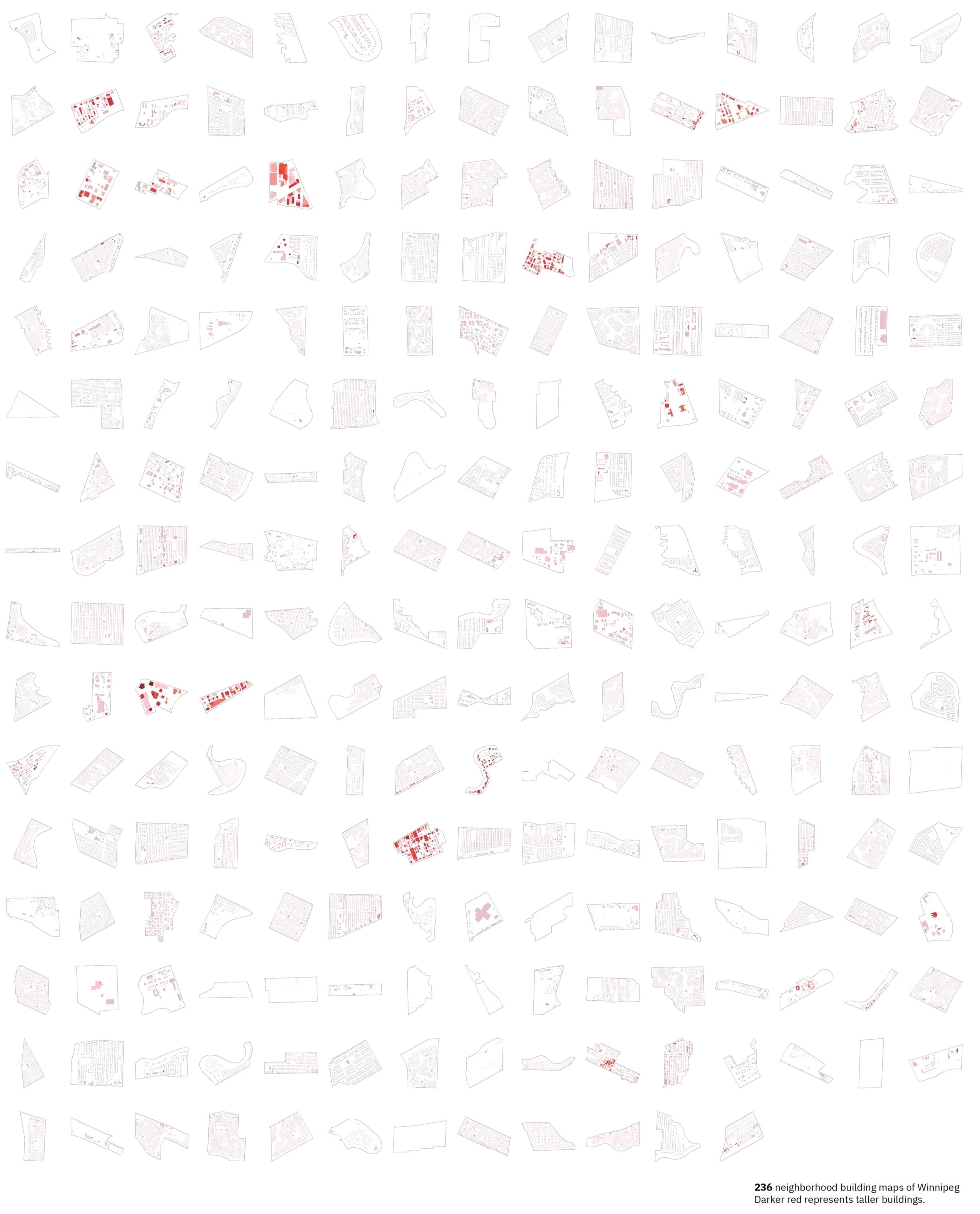
Winnipeg individual building data
Matthew Glowacki (MLA candidate), Zach Pankratz (B.Ed), and Yuhao Lu (PI)
(Dec 2024)
Data (.shp) can be accessed here (~57MB).
Web map can be accessed here (dark mode) and here (light mode). It might take up to 30 sec to render.
Over 240,000 buildings were mapped.
key attributes include:
als_ht: estimated building height (m)
age: building age (year) based on 2024 city assessment data
value: building/property value ($ CAD) based on 2024 city assessment data
wpg_name: neighborhood name
Many thanks to University of Manitoba’s URGP for partially funding this work.
We are also grateful to Compute Canada for providing reliable hosting for all our open datasets.
Methods
Our goal for the building data was to develop an accurate and data-rich building footprint dataset that would allow us to construct a 2.5D model for the city of Winnipeg.
There were four open-source footprint datasets at various levels of accuracy and detail: Microsoft (Microsoft, 2024), the Natural Resources Canada (NRCan, Government of Canada, 2023), Open Street Map (OSM, Feb 2024), and Maxim Fortin (Fortin, 2021). Maxim’s Open Building Population Layer and the NRCan Automatically Extracted Buildings datasets were the only sources that had building height data. None of the datasets contained building age. Additionally, the footprints from most sources were not geographically accurate when compared to Winnipeg’s aerial laser scan (ALS) tiles (City of Winnipeg, 2022). Microsoft’s Canadian Building Footprints were the least accurate from our geometric overlay assessment to the ALS tiles and had no additional attributes (e.g., height) that we required; therefore, it was not used in this study.
OSM and Maxim’s building data were the most geometrically accurate in relation to the ALS tiles. OSM’s data covered a majority of the city with a higher level of detail, showcasing different roof structures and smaller building annexes. Based on this information, OSM was selected as the base dataset for the footprint layer of the model. The next best footprint dataset was from Maxim which included building footprints absent from OSM and population estimates per footprint, providing more data on building uses. However, these polygons had slightly less geometric detail in their placement and orientation, as well as less footprint detail. Therefore, Maxim’s dataset was used as one of the supplemental sources to OSM’s data. The final dataset used was the NRCan dataset which included building footprints in new neighbourhoods that had been built within the last 5 years. However, it was observed in this dataset that there were many instances of large footprints covering multiple separate buildings, as well as many fragmented footprints. In these building footprints, there were also instances where only a sliver of a polygon was produced for a building. Considering these issues, NRCan’s data was only used in necessity for new developments outside the coverage of OSM or Maxim’s datasets, all other data was discarded.
To ensure the accuracy and completeness building height, the ALS dataset was used here. Median height (z) values of all building points (las classification code = 6) contained within each building footprint polygon were used to derive building heights. Utilizing parcel assessment data from the City of Winnipeg’s open data portal gave us semantic information about the building age as well as the number of stories for the primary building per parcel.
The current version of this dataset contains over 240,000 building footprints with an array of attributes useful for urban design and planning research.
We always stand behind open science and research transparency. Below are scripts for others to follow, modify, and improve.
R code for building height estimation: Download (ALS tile URLs are required input for the script. Download from here as a .txt file.)
HTML code for making the interactive web map: Download
More detail about this work (along with the tree map) will be shared in a forthcoming journal paper.
Reference
Fortin, M. (2021). OBPL.ca. Maxim Fortin. Retrieved December 7, 2024, from https://maximfortin.com/project/obpl-ca-2021/
Microsoft. 2024. Canadian building footprints [data set]. GitHub. https://github.com/microsoft/CanadianBuildingFootprints [accessed February 2024].
Open Street Maps. 2024. Buildings [data set]. [accessed February 2024].
Government of Canada. (2023). Canadian building footprints (2021) [Data set]. Open Government Portal. https://open.canada.ca/data/en/dataset/7a5cda52-c7df-427f-9ced-26f19a8a64d6 [accessed March 2024].
City of Winnipeg. 2022. Water and waste LiDAR [data set]. Winnipeg Open Data. https://data.winnipeg.ca/Water-and-Waste/Water-and-Waste-LiDAR/g634-qskh/about_data [accessed June 2024].
