June 5, 2026
Winnipeg, MB
1:30 - 2:30 PM (Central Time)
In person: John A. Russell Building 300 Level Studio space (map)
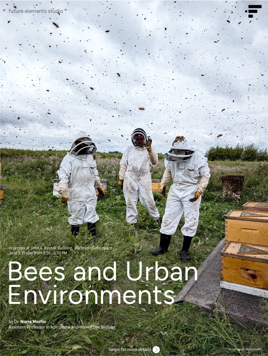
We are excited to welcome Dr. Nuria Morfin to kick off the first summer research talk in 2026.
Nuria Morfin is an Assistant Professor of honey bee biology and apiculture in the Department of Entomology, University of Manitoba. Prior to this position, Nuria led the British Columbia Technology Transfer Program for three years, instructed Honey Bee Biology at the University of Guelph, and worked with the Apiary Program at the Ontario Ministry of Agriculture, Food and Agribusinesses as a bee inspector.
She completed her PhD in Environmental Sciences at the University of Guelph’s Honey Bee Research Centre, following earlier studies in animal science and veterinary medicine at the National Autonomous University of Mexico. Nuria has worked with managed pollinators for more than 15 years, including neotropical bees and honey bees. Her research focuses on how biotic and abiotic stressors affect honey bee health and behaviour, behavioural immune responses, mechanisms of disease resistance, host-pathogen interactions, integrated pest management strategies for controlling Varroa destructor mites, and the pathogens that impact bee health and apiary productivity.
Nuria is a researcher, beekeeper, and extensionist who has collaborated on numerous projects across North America, contributing to the advancement of the beekeeping industry through research and education.
Past events (slides might be available in the description of certain events)
-
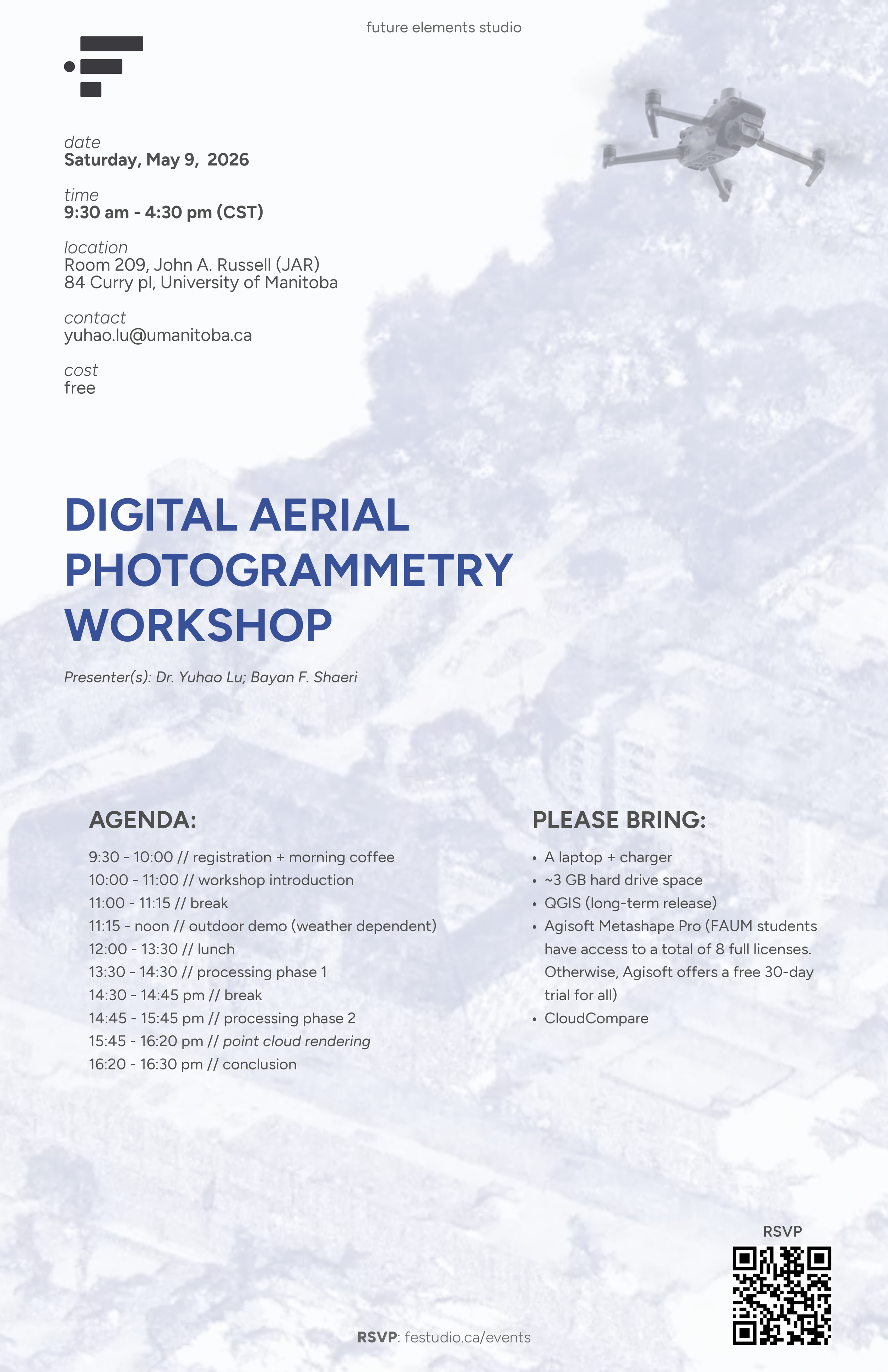
Join us for a hands-on workshop exploring the principles and applications of Digital Aerial Photogrammetry (DAP).
Participants will learn the fundamentals of DAP, collect aerial imagery (weather-dependent) using two UAVs (one consumer-grade and one advanced), and gain practical experience in transforming these images into high-resolution, high-fidelity 3D models and 2D point cloud renders.
All skill levels are welcome.
-
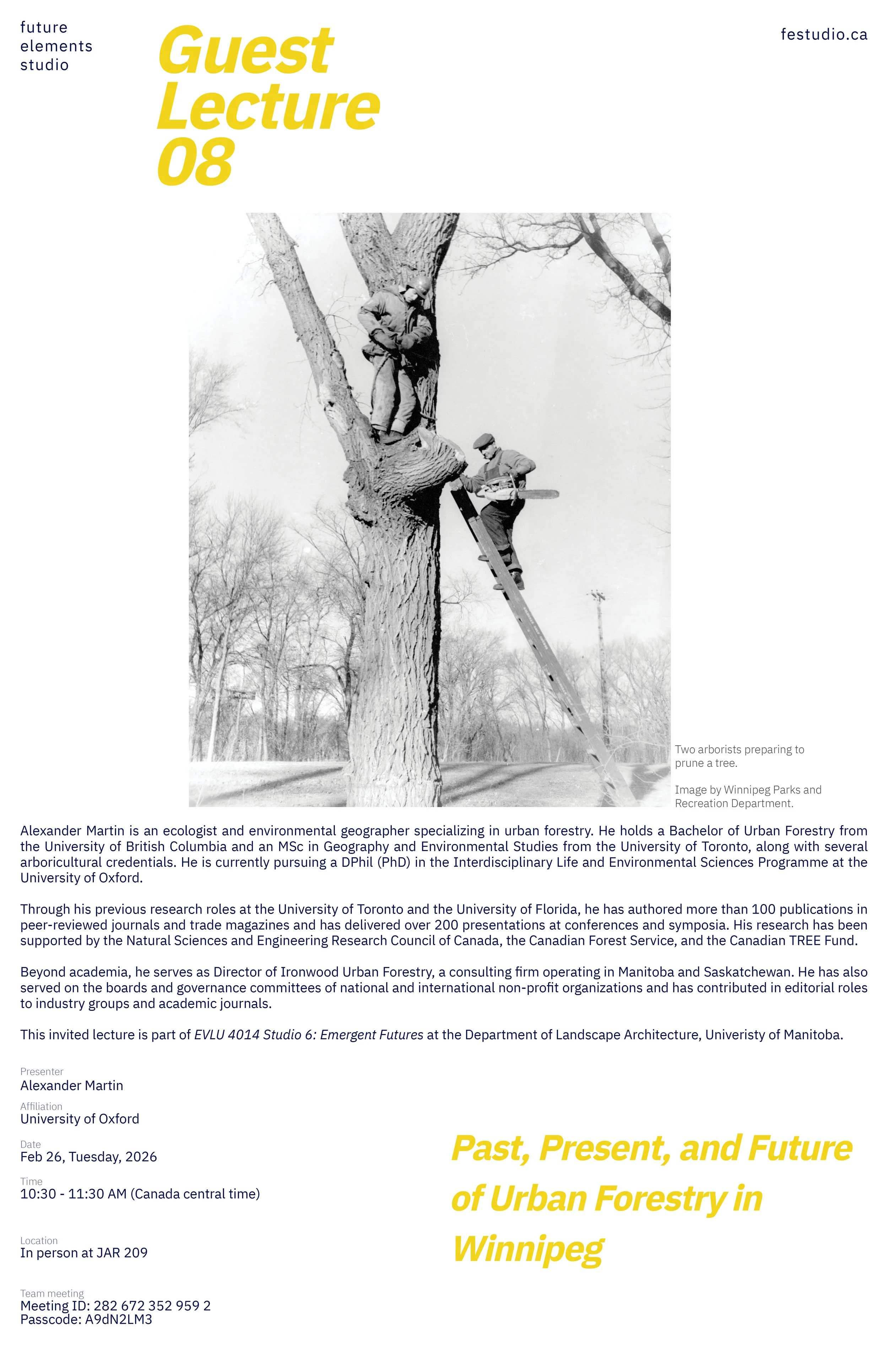
Alexander Martin is an ecologist and environmental geographer specializing in urban forestry. He holds a Bachelor of Urban Forestry from the University of British Columbia and an MSc in Geography and Environmental Studies from the University of Toronto, along with several arboricultural credentials. He is currently pursuing a DPhil (PhD) in the Interdisciplinary Life and Environmental Sciences Programme at the University of Oxford.
Through his previous research roles at the University of Toronto and the University of Florida, he has authored more than 100 publications in peer-reviewed journals and trade magazines and has delivered over 200 presentations at conferences and symposia. His research has been supported by the Natural Sciences and Engineering Research Council of Canada, the Canadian Forest Service, and the Canadian TREE Fund.
Beyond academia, he serves as Director of Ironwood Urban Forestry, a consulting firm operating in Manitoba and Saskatchewan. He has also served on the boards and governance committees of national and international non-profit organizations and has contributed in editorial roles to industry groups and academic journals.
-
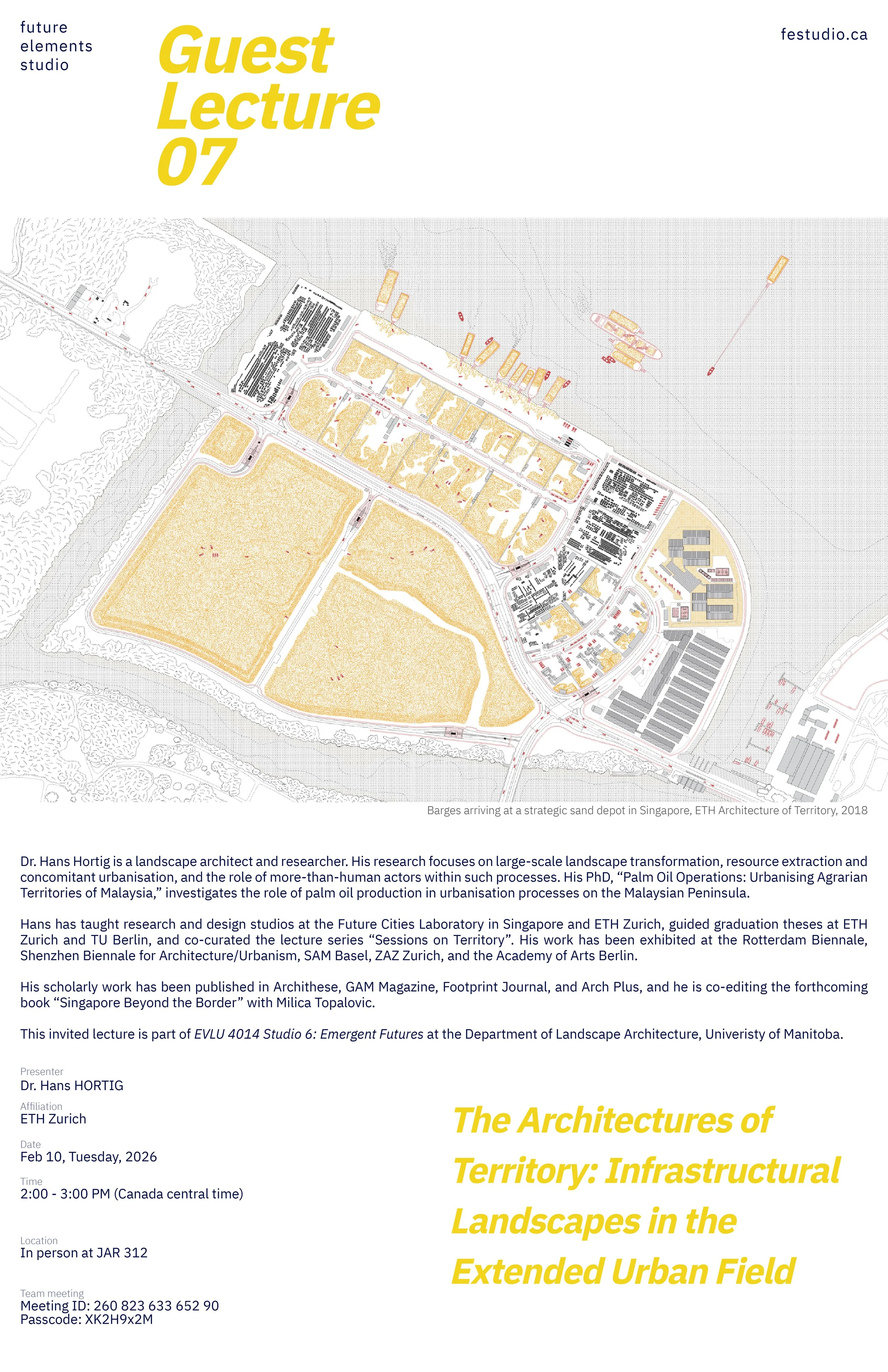
Dr. Hans Hortig is a landscape architect and researcher. His research focuses on large-scale landscape transformation, resource extraction and concomitant urbanisation, and the role of more-than-human actors within such processes. His PhD, “Palm Oil Operations: Urbanising Agrarian Territories of Malaysia,” investigates the role of palm oil production in urbanisation processes on the Malaysian Peninsula.
Hans has taught research and design studios at the Future Cities Laboratory in Singapore and ETH Zurich, guided graduation theses at ETH Zurich and TU Berlin, and co-curated the lecture series “Sessions on Territory”. His work has been exhibited at the Rotterdam Biennale, Shenzhen Biennale for Architecture/Urbanism, SAM Basel, ZAZ Zurich, and the Academy of Arts Berlin.
His scholarly work has been published in Archithese, GAM Magazine, Footprint Journal, and Arch Plus, and he is co-editing the forthcoming book “Singapore Beyond the Border” with Milica Topalovic.
This invited lecture is part of EVLU 4014 Studio 6: Emergent Futures at the Department of Landscape Architecture, Univeristy of Manitoba.
-
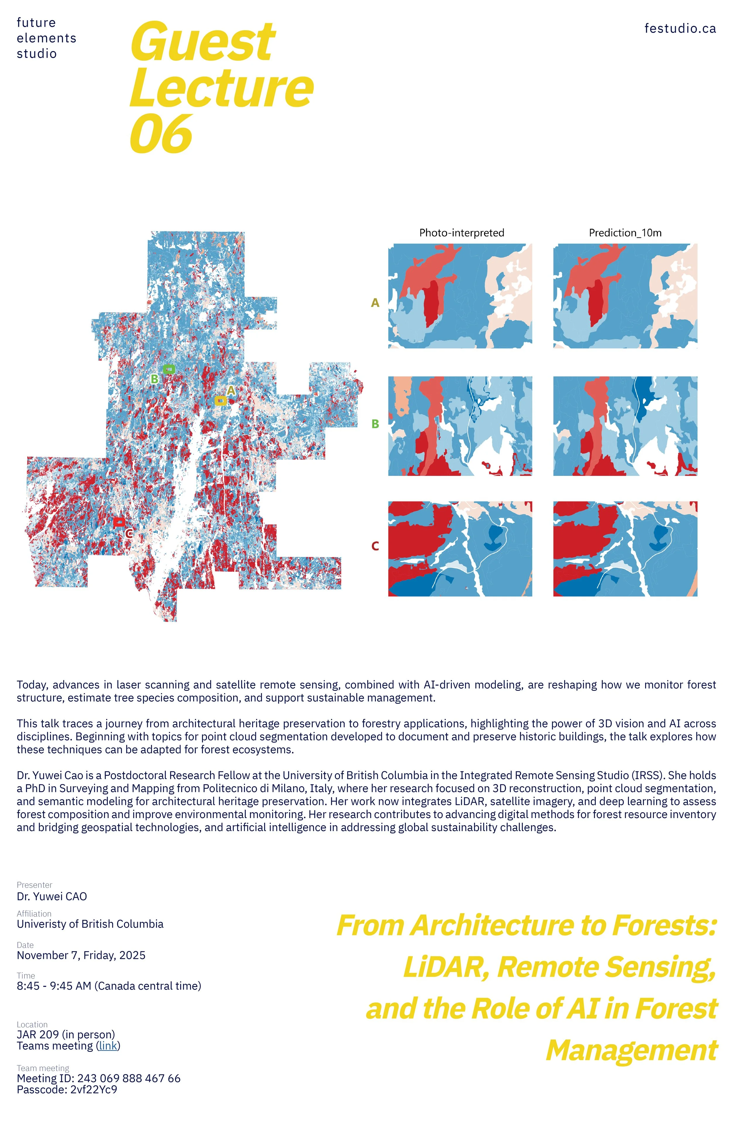
Today, advances in laser scanning and satellite remote sensing, combined with AI-driven modeling, are reshaping how we monitor forest structure, estimate tree species composition, and support sustainable management.
This talk traces a journey from architectural heritage preservation to forestry applications, highlighting the power of 3D vision and AI across disciplines. Beginning with topics on point cloud segmentation developed to document and preserve historic buildings, the talk explores how these techniques can be adapted for forest ecosystems.
Dr. Yuwei Cao is a Postdoctoral Research Fellow with the Integrated Remote Sensing Studio (IRSS) at the University of British Columbia. She holds a PhD in Surveying and Mapping from Politecnico di Milano, Italy, where her research focused on 3D reconstruction, point cloud segmentation, and semantic modeling for architectural heritage preservation. Her work now integrates LiDAR, satellite imagery, and deep learning to assess forest composition and improve environmental monitoring. Her research contributes to advancing digital methods for forest resource inventory and bridging geospatial technologies and artificial intelligence in addressing global sustainability challenges.
-
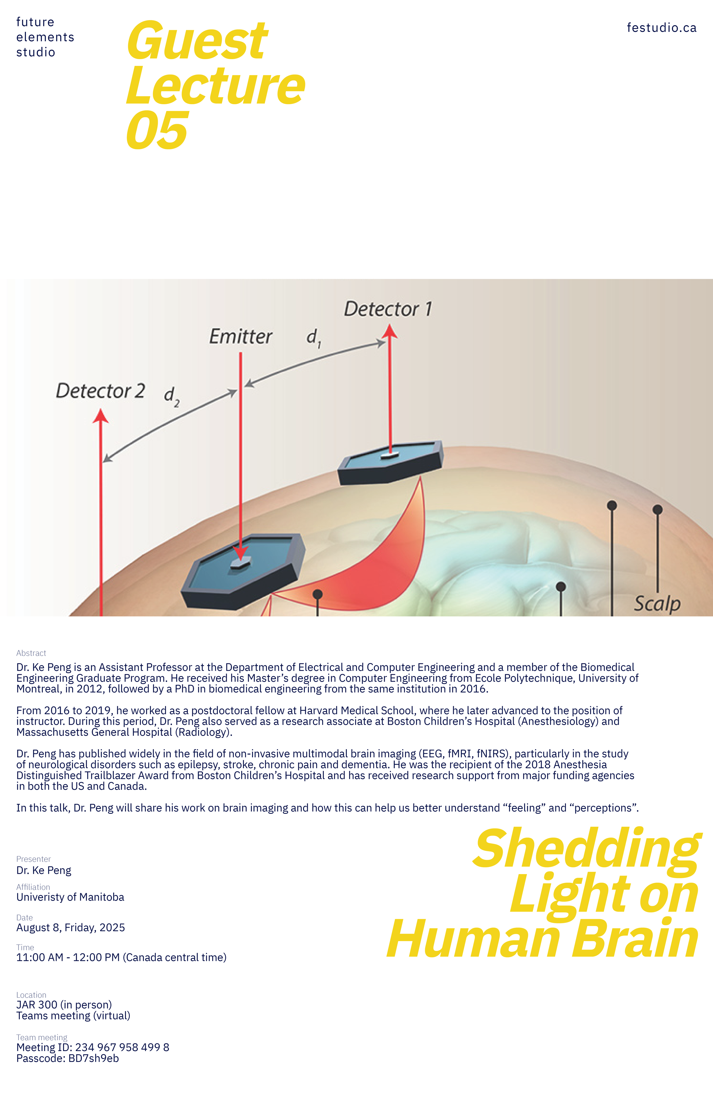
Dr. Ke Peng is an Assistant Professor at the Department of Electrical and Computer Engineering and a member of the Biomedical Engineering Graduate Program. He received his Master’s degree in Computer Engineering from Ecole Polytechnique, University of Montreal, in 2012, followed by a PhD in biomedical engineering from the same institution in 2016.
From 2016 to 2019, he worked as a postdoctoral fellow at Harvard Medical School, where he later advanced to the position of instructor. During this period, Dr. Peng also served as a research associate at Boston Children’s Hospital (Anesthesiology) and Massachusetts General Hospital (Radiology). Dr. Peng has published widely in the field of non-invasive multimodal brain imaging (EEG, fMRI, fNIRS), particularly in the study of neurological disorders such as epilepsy, stroke, chronic pain and dementia. He was the recipient of the 2018 Anesthesia Distinguished Trailblazer Award from Boston Children’s Hospital and has received research support from major funding agencies in both the US and Canada.
In this talk, Dr. Peng will share his work on brain imaging and how this can help us better understand “feelings” and “perceptions”.
-
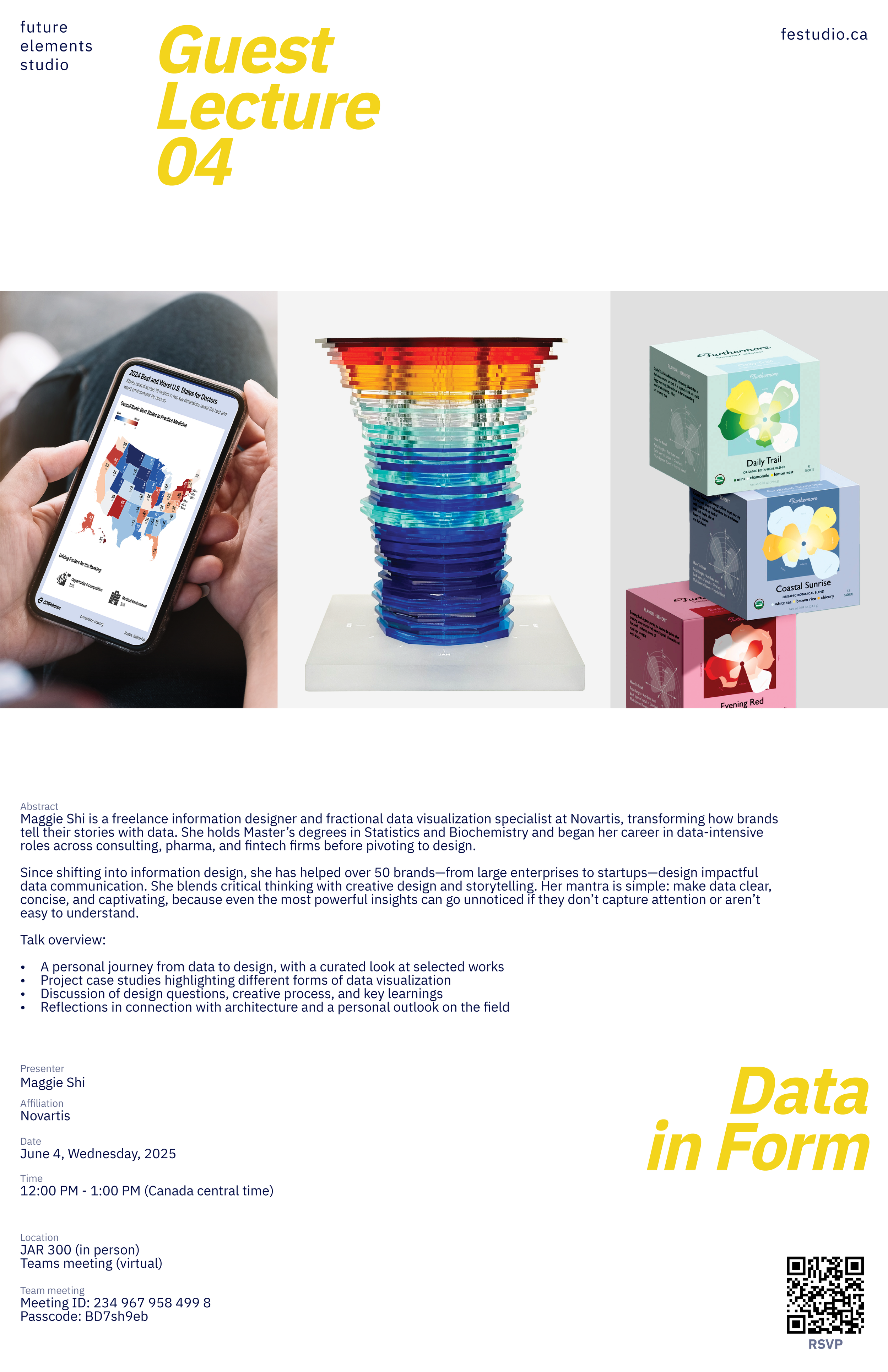
Maggie Shi is a freelance information designer and fractional data visualization specialist at Novartis, transforming how brands tell their stories with data. She holds Master’s degrees in Statistics and Biochemistry and began her career in data-intensive roles across consulting, pharma, and fintech firms before pivoting to design.
Since shifting into information design, she has helped over 50 brands—from large enterprises to startups—design impactful data communication. She blends critical thinking with creative design and storytelling. Her mantra is simple: make data clear, concise, and captivating, because even the most powerful insights can go unnoticed if they don’t capture attention or aren’t easy to understand.
Talk overview:
A personal journey from data to design, with a curated look at selected works
Project case studies highlighting different forms of data visualization
Discussion of design questions, creative process, and key learnings
Reflections in connection with architecture and a personal outlook on the field
-
This presentation explores how Flying Labs, integrating UAV-based platforms and satellite data, are developing the way we monitor, model, and interpret ecosystem dynamics. These airborne sensing systems enable fine-scale, real-time information on landscape change from vegetation dynamics to soil degradation. Explore multi-sensor integration, analytics, and modeling for new ecosystem assessment opportunities. Whether you’re a researcher, policymaker, or environmental practitioner, this session highlights innovative approaches to bridging observational data and decision-making in the face of accelerating climate impacts and land degradation across vulnerable ecosystems.
Dr. Nasem Badreldin is an Assistant Professor in digital agronomy at the University of Manitoba, Canada. He received his PhD in Geography from Ghent University (UGent) in Belgium (December 2013) and his MSc in Physical Land Resources from the Faculty of Bioscience Engineering in UGent (September 2008). He worked previously as a Postdoctoral Fellow at the Center for Earth Observation Sciences (CEOS) in the Department of Earth and Atmospheric Sciences at the University of Alberta in Canada and at the Department of Soil Science at the University of Manitoba and the University of Guelph in Canada, and as a Modeling Analyst in the Cumulative Impacts and Science Branch at the Saskatchewan Ministry of Environment.
-
Join us for a hands-on workshop exploring the principles and applications of Digital Aerial Photogrammetry. Participants will learn the fundamentals of DAP, collect aerial imagery (weather dependent) using two UAVs (one consumer-grade and one advanced), and gain practical experience transforming these images into high-resolution, high-fidelity 3D models.
These models are essential tools for analyzing terrain, vegetation, and the built environment.
All skill levels welcome.
-
Dr. Riccardo Tortini is a senior geospatial analyst at TRE Altamira, a world leader in land displacement monitoring with satellite radar data. He is trained in satellite remote sensing applications and holds a Ph.D. in geological engineering. With TRE Altamira, Riccardo has worked at over 50 projects leveraging InSAR data to assess the stability of ground, structures, and infrastructure in Canada, USA, and Australia.
Throughout his career, Riccardo has collaborated with national and international space agencies such as Canadian Space Agency (CSA), National Aeronautics and Space Administration (NASA), and European Space Agency (ESA).
His research was presented at international conferences and published in journals, including Earth System Science Data and Nature Scientific Reports.
In this presentation, we will hear first hand use of advanced earth monitoring and geospatial analytics in a professional setting.
-
Please join us this Friday Aug 30 1-2 pm for presentations by summer research students working with faculty members Yuhao Lu and Mark Meagher.
Students will present summer research projects in 3 minutes, followed by questions and discussion.
Presentations will be in the 3rd floor Arch 2 studio space, at the east end (closest to the John A. Russell Building).
-
Dr. Srilalitha (Sri) Gopalakrishnan is the Associate Director Research at the Future Cities Laboratory Global, Singapore-ETH Centre. She is trained as a landscape architect with over 15 years of professional experience and diverse projects across Singapore, Malaysia, China, Hong Kong, and India. Her research interests focus on the performance of integrated landscape design in dense urban environments for resilient and sustainable urban design solutions. She has published and presented her research in several journals and conferences, including International Journal on Smart and Sustainable Cities and Nature Scientific Reports. Sri’s work has also been exhibited at important international venues, such as the Singapore National Pavilion at the Venice Biennale 2023.
-
Haozhuo Yang is a candidate for the Master of Architecture in Urban Design at Harvard Graduate School of Design (Cambridge, US).
He holds a Bachelor of Architecture from Tongji University (Shanghai, China). He currently works on Smart City and AI projects with European public sectors at BABLE Smart City.
He is interested in data-driven methodologies in urban solutions. His research is centered around the integration of data and AI in the urban design process.